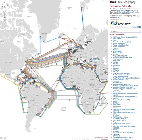
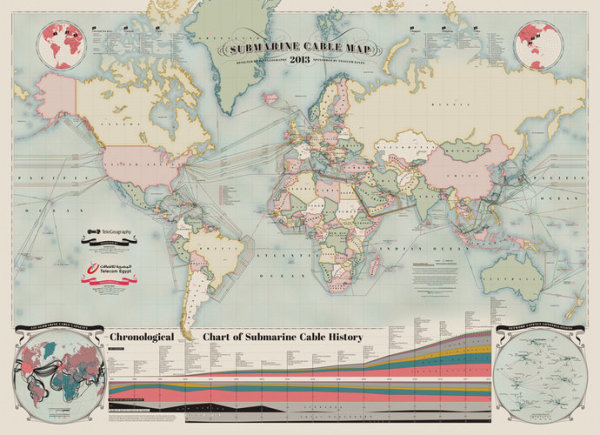
A beautiful map of the World’s undersea Internet cables, The Submarine Cable Map 2013. Brought to us be TeleGeography, sponsored by Telecom Egypt and design credit is listed as Nick Browning, Markus Krisetya, Larry Lairson, Alan Mauldin.
Cables depicted include all active international and U.S. domestic cables. In-service cables have an announced Ready for Service (RFS) date by December 31, 2012. Planned cables include those actively under construction and those that have announced they were fully funded as of year-end 2012. Map does not depict proposed cables that have not announced landings or configuration. Cable routes are stylized and do not reflect physical cable location.
I love the hand-drawn design style, meant to pay homage to old maps, but overlaid with very current information. This is also available for purchase as a poster 36” x 50” for $250.
An interactive website with more information about all of the cables is also run by TeleGeography and can be found at submarinecablemap.com

Found on FastCoDesign.
