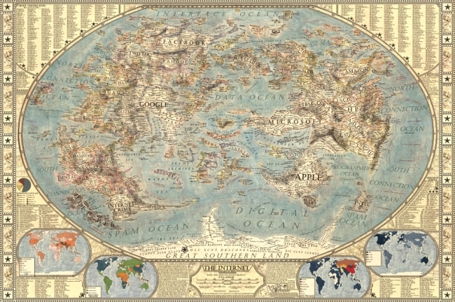
Designer Martin Vargic has released an updated version of his Map of the Internet 2.0 that creates what looks like a vintage-style map. However, this version plots out the major websites and technology companies, with related sites grouped together on the same continent. The sizes of the websites on the map are scaled relative to their number of visitors, so bigger sites show as bigger geographic regions.
Second version of our flagship project, the Map of the Internet.
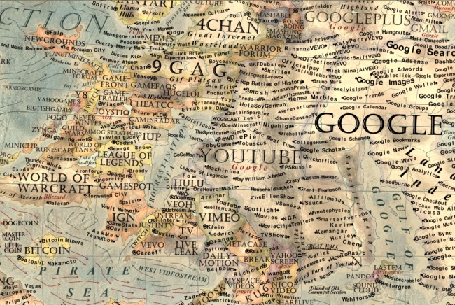
This conceptual work of cartography treats major internet sites and enterprises such as Google, Yahoo, Microsoft, HP, and Apple like sovereign states, on a classic map of the world. To explain the dominance and relationships of these entities, they were all given a visual hierarchy that gives prominent treatment to companies with the most users (or sites with the most visitors), surrounding them with smaller countries representing related websites and services.
This poster includes one full map of the internet, 4 minimaps showcasing NSA surveillance, most used social networks, most used internet browser, and worldwide internet penetration, list of Alexa Top 500 websites, quick timeline of the Internet History, top software companies and much more!
The map includes more than 250 separate websites/enterprises as sovereign states, and more than 2000 separate labels.
A high-resolution version is available online, and you can also order 24” x 36” printed posters on Zazzle.
This what I call a 2nd level design, which means it’s a highly detailed design that is meant to present a ton of information to the audience. This type of design isn’t trying to communicate a key message in a few seconds, but is intended for readers to zoom-in and explore.
Found on Business Insider
 Randy
Randy