


Thursday
Mar132008
The Eisenhower Interstate System
 Randy
Randy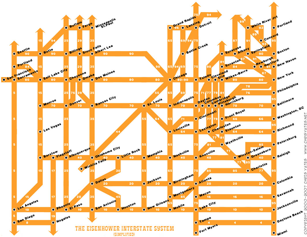
What a fantastic way to simplify the U.S. interstate system into an easy to understand graphic. From Chris Yates on chrisyates.net. Style looks like a subway map.
Found on Digg.

![]()

Join the DFW Data Visualization and Infographics Meetup Group if you're in the Dallas/Fort Worth area!

The Cool Infographics® Gallery:
How to add the
Cool Infographics button to your:

- iPhone
- iPad
- iPod Touch
Read on Flipboard for iPad and iPhone
Featured in the Tech & Science category


What a fantastic way to simplify the U.S. interstate system into an easy to understand graphic. From Chris Yates on chrisyates.net. Style looks like a subway map.
Found on Digg.

Reader Comments (1)
Nat Case of Hedberg Maps created a different version of this, http://www.hedbergmaps.com/store/catalog/10669" REL="nofollow">which can be found on their web site.
There was also a discussion of both of these maps on http://www.cartotalk.com/index.php?showtopic=1671" REL="nofollow">CartoTalk.